Mostly, I'm consulting these old maps as a source for my efforts documenting and describing my family's history, but I made a point, today, of also scanning the zones in which our district's two colleges later appeared (in 1968* and 1979).
Here's Google's current image/map of the area surrounding Irvine Valley College:
 |
| Click on graphics to ENLARGE |

In this map from the 1963 Thomas Guide, IVC's future location is marked by my red X—on the corner of Valencia (later "Irvine Center Drive") and Jeffrey. Nearby Sand Canyon is called "Central" Ave., and the San Diego Fwy is described as "proposed."
As I've explained previously, I've been told that the originally proposed site of this college (Saddleback College, north campus—it wasn't called IVC until 1985) was on Jamboree—the location of today's Tustin Market Place. But the Irvine Company provided "free" land on Jeffrey, and so the location was changed. (The city of Tustin is still peeved that "Irvine stole its college"! That's the story, anyway.)

Here's a contemporary map of the region including Saddleback College (top) and San Juan Capistrano to the south (at the 74—the Ortega Highway). The red line in the middle is the location of Rosenbaum Rd., which exists today and existed also in 1963.
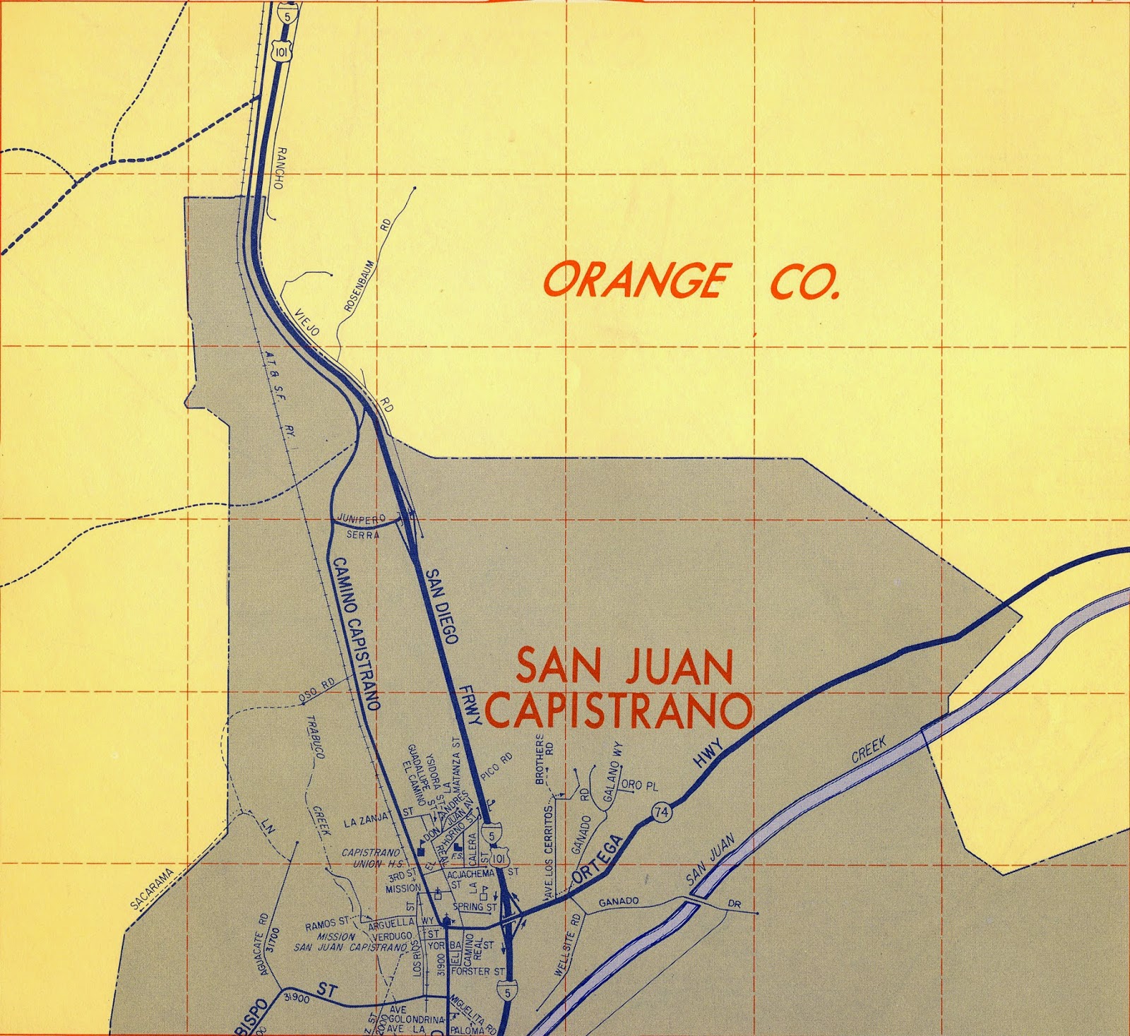
And here we see most of the same area as of 1963 (I'm afraid I cut too much off the top—I'll correct that later.) Note the location of Rosenbaum Rd.
The future location of Saddleback College is at the very top of the image, just east of the 5.
*Actually, the original site of the college, when it opened in Sept of 1968, was (temporarily) at 26522 Crown Valley Parkway, a half mile to the north. The temporary structures that contained the college in those days were moved to the current site, along Avery, a year or so later. See image below:
 |
| The red dot indicates SC's original location. Its ultimate location is the complex at the bottom of the graphic. |


No comments:
Post a Comment